TopNewsOn

Results for “season finale”

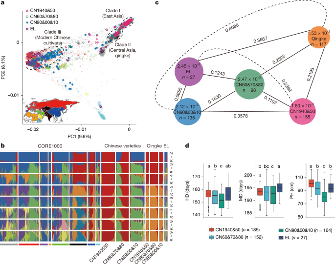
Two genes, two harvests: Adapting barley for double cropping

Growing two crops in succession on the same land requires a tight schedule. In parts of central and eastern China, farmers sow barley in autumn and harvest it in late spring. It is then followed by a summer crop, such as rice. For this cropping sequence to succeed, the barley must mature in time. An early harvest also helps the crop avoid heat and rain toward the end of the growing season.

Phys.org · Nov 9
Student finds proof of rare wild cat in northern New Mexico

Armed with dozens of motion-sensing cameras, William Grooms spent this past summer documenting wildlife across Carson National Forest in northern New Mexico. It was his first field season collecting photos for a two-year study to understand how forest structure influences biodiversity in the Southern Rocky Mountains.

Phys.org · Nov 7
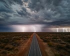
Thunderstruck: what does the future hold for lightning?

Humans have always been awed by the power and beauty of lightning. How does the experience and understanding of it change in a warming world? In a rock shelter in Kakadu national park in the north of Australia is an image of a being the Bininj people call Namarrkon . His flesh bleached away to reveal the bones beneath, he wears stone axes on his head, elbows and knees, and wields a great band of lightning that runs from his ankles up, over his head. Namarrkon’s journey from the Arafura Sea to the Arnhem Land escarpment helped shape the landscape, according to the dreamtime stories of the Bininj. And in the great storms that arc and rumble across the landscape during the buildup and the wet season, it is Namarrkon who splits the clouds with his stone axes to create the thunder and lightning and release the life-giving rain. Continue reading...

The Guardian · Nov 7
Researchers use seasonal satellite imagery to map shrub encroachment in Inner Mongolia grasslands

Researchers from the Aerospace Information Research Institute of the Chinese Academy of Sciences (AIRCAS) used satellite images collected across the growing season to map shrub cover in the grasslands of Inner Mongolia, China. By tracking seasonal differences in growth, they were able to distinguish shrub patches from dense grass, which can look similar in a single image.

Phys.org · Nov 4